Schotland
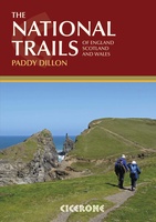 Wandelgids the National Trails - Great British Walks - Engeland, Wales en Schotland | Cicerone
Guidebook to Britain's National Trails - 19 long-distance walking routes through England, Wales and Scotland, describing what makes each of them so special and providing the practical information to help …
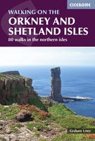 Wandelgids Walking guide to the Orkney and Shetland Isles | Cicerone
Uitstekende wandelgids van dit geweldige gebied. goed beschreven met veel praktische informatie om de route te kunnen lopen, inclusief redelijke kaarten. A guidebook to 80 walking routes on Scotland's Northern …
★★★★★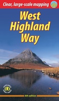 Wandelgids West Highland Way | Rucksack Readers
Uitgevoerd in de vorm van een klapper, met ringband geeft deze gids een goede beschrijving van de lange afstands route. De kaarten zijn schetsmatig maar wel duidelijk. The West Highland …
★★★★★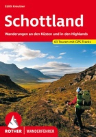 Wandelgids Schottland - Schotland | Rother Bergverlag
Uitstekende wandelgids met een groot aantal dagtochten in dal en hooggebergte. Met praktische informatie en beperkt kaartmateriaal! Wandelingen in verschillende zwaarte weergegeven in rood/blauw/zwart Schottland ist bekannt für seine atemberaubenden …
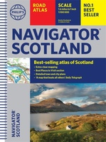 Wegenatlas Navigator Scotland | A4-Formaat | Ringand | Philip's Maps
Duidelijke en gedetailleerde atlas van Schotland met enkele stadsplattegronden en register. Zuid Schotland is van schaal 1:100.000 en het noorden met schaal 1:200.000 Philip's Navigator Scotland is part of …
★★★★★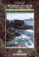 Wandelgids Walking on Rum and the Small Isles - Schotland | Cicerone
A handy guidebook to walking and backpacking in the Western Isles of Scotland on Rum, Eigg, Muck, Canna, Coll and Tiree including a tough 55km backpack around the coast …
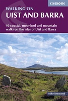 Wandelgids Walking on Uist and Barra - Schotland | Cicerone
This guide offers 40 varied and graded walking routes on the unique 100km cluster of islands that make up Uist and Barra. From short, flat beach walks beside crystal clear …
★★★★★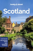 Reisgids Scotland - Schotland | Lonely Planet
Lonely Planet Schotland De lonley planet Schotland is de perfecte reisgids voor Schotland voor zowel de georganiseerde als de zelfstandige reiziger voor Schotland. Naast een algemene inleiding van het land …
★★★★★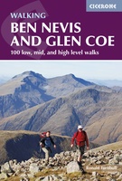 Wandelgids Ben Nevis and Glen Coe | Cicerone
Uitstekende wandelgids van Ben Nevis en Glen Coe. Goed beschreven met veel praktische informatie om de route te kunnen lopen, inclusief redelijke kaarten. This guidebook details 100 walking routes around …
★★★★★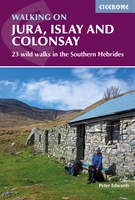 Wandelgids Walking on Jura, Islay and Colonsay | Cicerone
Uitstekende wandelgids van deze weldadige eilanden. goed beschreven met veel praktische informatie om de route te kunnen lopen, inclusief redelijke kaarten. This guidebook presents a selection of 23 walking routes …
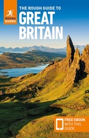 Reisgids Great Britain - Groot Britannië | Rough Guides
Zeer goede reisgids voor zowel de georganiseerde maar vooral voor de zelfstandige reiziger. Boordevol informatie over reizen, slapen, eten, maar ook musea en cultuur. Voor veel landen meestal completer en …
 Wegenkaart - landkaart Great Britain - Engeland - Schotland | ITMB
Een degelijke kaart met aanduidingen van o.a. nationale parken, vliegveld, benzinepomp, dirt-roads en kleine plattegrond van hoofdstad. Als overzichtskaart goed te gebruiken. This is the third set of …
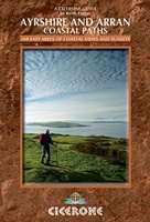 Wandelgids Ayrshire and Arran Coastal Paths | Cicerone
A guide to walking or backpacking along the Ayrshire and Arran Coastal Paths, which stretch for over 150 miles along the stunning west coast of Scotland, within easy reach of …
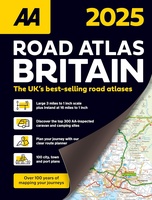 Wegenatlas Road Atlas Britain 2025 - A4 | AA Publishing
Wegenatlas, met spiraal, van Groot-Brittannie, Engeland, Wales en Schotland, met toeristische informatie This top-selling road atlas showcases Britain’s clearest mapping from the experts at the AA at a large 3.2 …
★★★★★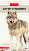 Natuurgids Veldgids Europese Zoogdieren | KNNV Uitgeverij
Een praktische natuurgids en een compleet naslagwerk. Niet eerder werden alle zoogdieren van Europa en hun sporen zo fraai en compleet in beeld gebracht. Inclusief soorten die nieuw zijn voor …
★★★★★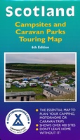 Camperkaart - Campinggids Scotland Campsites and Caravan Parks - Touring map | Scottishcamping.com
Dit soort kaarten zouden ze voor elk land moeten maken: heel duidelijk weergegeven vind je hier alle campings in Schotland op de voorzijde en op de achterzijde de adressen en …
 Wegenkaart - landkaart 9 Road Map Britain Scotland - Schotland | AA Publishing
Goede dubbelzijdige wegenkaart van Schotland met plaatsnamen index. Britain’s clearest mapping from the experts at the AA, in a handy foldable map. Fully updated, this map of Scotland combines clear …
★★★★★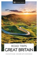 Reisgids Road Trips Great Britain | Dorling Kindersley
25 routes – uiteenlopend van een tot vijf dagen – brengen u diep het ongerepte Engelse platteland in, met onderweg charmante eethuizen en accommodatie. Bij elke route hoort een wandeling …
★★★★★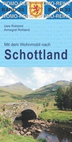 Campergids 33 Mit dem Wohnmobil nach Schottland - Camper Schotland | WOMO verlag
Bijzonder nuttige camperreisgids van een bepaald land of streek. Deze Duitstalige campergids beschrijft aan de hand van een aantal routes de mooiste gebieden. Naast een beschrijving van de routes zelf …
★★★★★★★★★★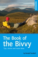 Survivalgids The Book of the Bivvy - Bivak | Cicerone
A guide to the bivouac - the pinnacle of minimalist wild-camping. Accounts of bivvybag adventures, both nice and nasty, alternate with practical chapters on lightweight kit and long-distance bivvying, and …
Laatste reviews

Kan de huidige ontstuimige ontwikkelingen wereldwijd, nu ook geografisch plaatsen en daarmee beter volgen.
★★★★★ door Leo Janssen 20 december 2024 | Heeft dit artikel gekocht
We hadden Piëmonte al eens bezocht en voor onze komende reis werd ons door kennissen deze gids aanbevolen. Inderdaad is dit een heel goede gids. …
★★★★★ door DWKdB 19 december 2024 | Heeft dit artikel gekocht
Mijn bestellingen zijn altijd goed en worden altijd op tijd geleverd. Komen afspraken goed na. Erg tevreden.
★★★★★ door Ben Wegdam 19 december 2024 | Heeft dit artikel gekocht
Zeer gedetailleerde kaart van het zuidelijke deel van het douaniers pad
★★★★★ door Marian 18 december 2024 | Heeft dit artikel gekocht

