♦ Peak District Nationaal Park
 Wandelgids 073 Pathfinder Guides More Peak District | Ordnance Survey
This companion to the Pathfinder Peak District Guidebook contains 28 additional circular walks of 3 to 10.5 miles. Like the main book, each is graded length difficulty, and ranger from …
 Wandelgids Peak District | Northern Eye Books
Klein, handzaam wandelgidsje met wandelingen in het Peak District. Met goede kaartjes van Ordnance Survey. Discover the very best of the Peak District. These ten themed walks explore the …
 Wegenkaart - landkaart National Park Pocket Map Peak District | Collins
Handige kleine kaart van dit Nationaal Park. De kaart geeft een goed en helder overzicht van het gebied met alle plaatsen, doorgaande wandelpaden (alhoewel grof van schaal), bezienswaardigheden etc. Met …
 Wandelgids Park Rangers Favourite Walks Peak District | Collins
The perfect companions for exploring the National Parks. Walking guide to the Peak District National Park, with 20 best routes chosen by the park rangers. Each walk varies in length …
★★★★★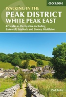 Wandelgids Walking in the Peak District - White Peak East | Cicerone
Uitstekende wandelgids van het Peak District van de gerenommeerde uitgever Cicerone. This guidebook provides 35 day walks and 7 longer walks and trails exploring the eastern section of Derbyshire's …
★★★★★ Wandelgids 063 Pathfinder Guides Peak District | Ordnance Survey
Wandelgids van een deel van Engeland, Schotland of Wales. Deze gids bevat 28 dagwandelingen, variërend van korte tochten tot pittige dagtochten. De bijbehorende kaarten zijn uitstekend: men heeft de topografische …
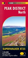 Wandelkaart Peak District Noord | Harvey Maps
New, Superwalker XT25 of the Peak District. Revised and re-designed It's got everything! Genuine original HARVEY mapping at 1:25,000. Ideal for walking. Clear, easy to read. Easy to re-fold. Opens …
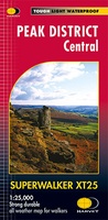 Wandelkaart Peak District Central | Harvey Maps
New Superwalker XT25 of the Peak District Revised and re-designed. It's got everything! Genuine original HARVEY mapping at 1:25,000. Ideal for walking. Clear, easy to read. Easy to re-fold. Opens …
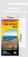 Wandelkaart Peak District Noord | Harvey Maps
HARVEY launch innovative new series: Ultramap XT40. 16 titles featuring in Trail magazine through spring 2016. 40 years experience have gone into HARVEY's most creative new series. The Ultramap covers …
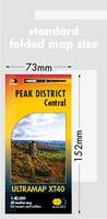 Wandelkaart Peak District Central | Harvey Maps
HARVEY launch innovative new series: Ultramap XT40. 16 titles featuring in Trail magazine through spring 2016. 40 years experience have gone into HARVEY's most creative new series. The Ultramap covers …
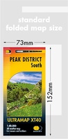 Wandelkaart Peak District Zuid | Harvey Maps
HARVEY launch innovative new series: Ultramap XT40. 16 titles featuring in Trail magazine through spring 2016. 40 years experience have gone into HARVEY's most creative new series. The Ultramap covers …
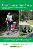 Fietsgids The Ultimate Trans Pennine Trail Guide | Excellent Books
Gidsboek voor de Trans Pennine Trail met spiraalbinding, inclusief kaarten, hoogtegrafieken en verblijfsmogelijkheden. The Trans Pennine Trail guide book covers the hugely popular 370 miles (595km) of trail across the …
 Wandelkaart National Trail Map Pennine Way | Collins
Overzichtskaart op vrij grove schaal van deze LAW Lange Afstands Wandeling in Engeland. Let op: je kunt er niet op lopen. Wel met veel informatie op de kaart, goed ingetekend, …
 Wandelgids Pennine Way | Aurum Press
Goede beschrijving van de aantrekkelijke route. Kaartmateriaal van Ordnance Survey - de Engelse topografische dienst op een schaal van 1:25.000. Praktische info voor overnachten ed. niet altijd uitgebreid, maar die …
 Wandelgids Peak District: Walks to Viewpoints | Northern Eye Books
This handy pocket size book will take you on short circular walks to the ten finest views and viewpoints in the Peak District. Views are why many of us …
 Reisgids Central England - Centraal Engeland | Wild Things Publishing
Prachtige reisgids van Centraal Engeland waarbij nadrukkelijk de natuur en buitensportmogelijkheden worden uitgelicht. Met kaarten en wat praktische informatie. A new compendium of adventures, from the best-selling Wild Guide series …
 Wandelkaart Peak District South | Harvey Maps
Een bijzonder handige kaart van dit gebied. Op waterafstotend papier met veel details. Covers the area from Buxton to Matlock. Includes Leek, the Roaches and Dovedale. Detailed map for …
 Wandelgids Short Walks in the Peak District | Collins
A brand new range of practical little walk guides endorsed by the Ramblers. All the walks are 5 miles or under in length and can easily be completed in less …
 Wandelgids Mountain Walks Kinder | Vertebrate Publishing
Mountain Walks Kinder Scout by Sarah Lister is a guide to walking routes up and around Kinder Scout in the Peak District. Alongside the routes up to the plateau, there …
 Reisboek - Wandelgids Wild Swimming Walks Peak District | Wild Things Publishing
The best-selling Wild Swimming Walks series returns with adventures in Britain's oldest National Park. Ascend to the highest tarns and descend through a valley of secret waterfalls * Walk through …
Laatste reviews

Uitgebreide en zeer overzichtelijke kaart, bijna alles staat erop. Handig formaat en past mooi bij de aangeschafte gids.
★★★★★ door Toon Meesters 02 januari 2025 | Heeft dit artikel gekocht
Wil komende zomer naar dit schiereiland. Dit boek heeft ons nog enthousiaster gemaakt. Zeer informatief en volledig en toch in handig formaat
★★★★★ door Toon Meesters 02 januari 2025 | Heeft dit artikel gekocht
Goede omschrijving van producten, Duidelijke website en zoekmachine Snelle levering Zeer tevreden
★★★★★ door Paul Out 02 januari 2025 | Heeft dit artikel gekocht
Pakket is met de feestdagen snel en netjes verzonden. Is precies de landkaart die we zochten. Erg tevreden
★★★★★ door Marieke 01 januari 2025 | Heeft dit artikel gekocht