Kaarten - ♦ Devon - Cornwall
 Wandelkaart - Topografische kaart 118 OS Explorer Map Shaftesbury & Cranborne Chase | Ordnance Survey
Met zijn 4cm voor 1 km (2 ½ cm voor 1 mijl) schaal, is de OS Explorer kaartenserie de ideale en meest gedetailleerde kaartenreeks voor mensen die graag outdoor-activiteiten zoals …
 Wandelkaart - Topografische kaart 126 OS Explorer Map Clovelly & Hartland | Ordnance Survey
Met zijn 4cm voor 1 km (2 ½ cm voor 1 mijl) schaal, is de OS Explorer kaartenserie de ideale en meest gedetailleerde kaartenreeks voor mensen die graag outdoor-activiteiten zoals …
 Wandelkaart - Topografische kaart 127 OS Explorer Map South Molton & Chulmleigh | Ordnance Survey
Met zijn 4cm voor 1 km (2 ½ cm voor 1 mijl) schaal, is de OS Explorer kaartenserie de ideale en meest gedetailleerde kaartenreeks voor mensen die graag outdoor-activiteiten zoals …
 Wandelkaart - Topografische kaart 128 OS Explorer Map Taunton & Blackdown Hills | Ordnance Survey
Met zijn 4cm voor 1 km (2 ½ cm voor 1 mijl) schaal, is de OS Explorer kaartenserie de ideale en meest gedetailleerde kaartenreeks voor mensen die graag outdoor-activiteiten zoals …
★★★★★ Wandelkaart - Topografische kaart 129 OS Explorer Map Yeovil & Sherborne | Ordnance Survey
Met zijn 4cm voor 1 km (2 ½ cm voor 1 mijl) schaal, is de OS Explorer kaartenserie de ideale en meest gedetailleerde kaartenreeks voor mensen die graag outdoor-activiteiten zoals …
 Wandelkaart - Topografische kaart 130 OS Explorer Map Salisbury & Stonehenge | Ordnance Survey
Met zijn 4cm voor 1 km (2 ½ cm voor 1 mijl) schaal, is de OS Explorer kaartenserie de ideale en meest gedetailleerde kaartenreeks voor mensen die graag outdoor-activiteiten zoals …
 Wandelkaart - Topografische kaart 139 OS Explorer Map Bideford & Ilfracombe & Barnstaple | Ordnance Survey
Met zijn 4cm voor 1 km (2 ½ cm voor 1 mijl) schaal, is de OS Explorer kaartenserie de ideale en meest gedetailleerde kaartenreeks voor mensen die graag outdoor-activiteiten zoals …
 Wandelkaart 3 South West Coast Path 3 | Harvey Maps
Een bijzonder handige kaart voor een deel van dit lange-afstands-wandelpad (Minehead tot St Ives) van het in totaal maar liefst 1014 km lange South West Coast Path. Op waterafstotend papier …
★★★★★★★★★★ Wandelkaart Two Moors Way | Harvey Maps
Een bijzonder handige kaart van dit lange-afstands-wandelpad. Op waterafstotend papier met veel details. Het enige dat je eigenlijk een beetje mist is een overzicht. Verder uitstekend en voldoende voor de …
 Wandelatlas 5 Adventure Atlas South West Coast Path - Dorset | A-Z Map Company
AZ heeft de meest gedetailleerde wandelkaarten van delen van het South West Coast Path gebundeld in een atlasje. Daardoor is het heel handig qua formaat. De kaarten zelf zijn perfect …
 Wandelatlas 2 Adventure Atlas South West Coast Path North Cornwall | A-Z Map Company
AZ heeft de meest gedetailleerde wandelkaarten van delen van het South West Coast Path gebundeld in een atlasje. Daardoor is het heel handig qua formaat. De kaarten zelf zijn perfect …
★★★★★ Wegenkaart - landkaart Wales & southwest England | ITMB
Een degelijke kaart met aanduidingen van o.a. nationale parken, vliegveld, benzinepompen. Finally, we have been able to create our own map of the lovely country of Wales. I use the …
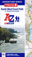 Wandelatlas 3 Adventure Atlas South West Coast Path South Cornwall | A-Z Map Company
AZ heeft de meest gedetailleerde wandelkaarten van delen van het South West Coast Path gebundeld in een atlasje. Daardoor is het heel handig qua formaat. De kaarten zelf zijn perfect …
★★★★★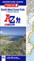 Wandelatlas 4 Adventure Atlas South West Coast Path South Devon | A-Z Map Company
AZ heeft de meest gedetailleerde wandelkaarten van delen van het South West Coast Path gebundeld in een atlasje. Daardoor is het heel handig qua formaat. De kaarten zelf zijn perfect …
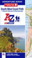 Wandelatlas 1 Adventure Atlas South West Coast Path North Devon & Somerset | A-Z Map Company
AZ heeft de meest gedetailleerde wandelkaarten van delen van het South West Coast Path gebundeld in een atlasje. Daardoor is het heel handig qua formaat. De kaarten zelf zijn perfect …
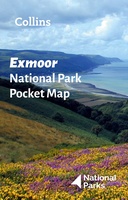 Wegenkaart - landkaart National Park Pocket Map Exmoor | Collins
Handige kleine kaart van dit Nationaal Park. De kaart geeft een goed en helder overzicht van het gebied met alle plaatsen, doorgaande wandelpaden (alhoewel grof van schaal), bezienswaardigheden etc. Met …
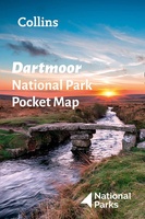 Wegenkaart - landkaart National Park Pocket Map Dartmoor | Collins
Handige kleine kaart van dit Nationaal Park. De kaart geeft een goed en helder overzicht van het gebied met alle plaatsen, doorgaande wandelpaden (alhoewel grof van schaal), bezienswaardigheden etc. Met …
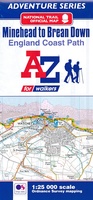 Wandelatlas Adventure Atlas Minehead to Brean Down - England Coast Path | A-Z Map Company
Gedetailleerde wandelkaart van een gedeelte van het England Coast Path. The A-Z Adventure Series of maps combines the best of OS and A-Z, creating the perfect companion for walkers, …
 Fietskaart 01 Cycle Maps UK Cornwall and West Devon | Cordee
Een nieuwe fietskaarten serie van Groot-Brittannië. Gedrukt op scheur- en watervast papier en mooi handzaam klein formaat. Deze kaarten zijn met name heel goed om de Lange Afstands Fietsroutes (LF) …
 Fietskaart 01 Cycling guides Cornwall | Goldeneye
Our maps are double-sided, printed on an A2 sheet with a concertina fold. This allows for easy folding and folding, and an ease of access to the mapping. The material …
Laatste reviews

Heb de gids cadeau gedaan en die persoon was er heel blij mee ..
★★★★★ door J 21 november 2024 | Heeft dit artikel gekocht
De kaart van Kirgystan is prachtig, zeer gedetailleerd. Kan niet wachten tot de we echt op reis hmgaan die kant op.
★★★★★ door Marijke Eering 21 november 2024 | Heeft dit artikel gekocht
Super handig fiets boekje en mooi water bestendig. En handig om op de kaarten te kijken heel duidelijk beschrijving. Wij fietsen al jaren in Duitsland …
★★★★★ door Jenneke holterman 19 november 2024 | Heeft dit artikel gekocht
prima kaart levering en betaling allemaal vlot verlopen
★★★★★ door Marc Buts 19 november 2024 | Heeft dit artikel gekocht