Engeland
 Wegenkaart - landkaart England & Wales - Engeland | ITMB
Een degelijke kaart met aanduidingen van o.a. nationale parken, vliegveld, benzinepompen. ITMB publishes a map of Great Britain, but each portion of GB needs its own map to show roads …
 Campinggids Campingführer Deutschland & Nordeuropa - Duitsland & Noord Europa 2024 | ADAC
Erg uitgebreide campinggids van Noord Europa, in het Duits. Met gratis ADAC kortingskaart. Mit dem ADAC Campingführer Deutschland/Nordeuropa wird die Suche nach dem perfekten Campingplatz zum Vergnügen. Ob Urlaub vor …
★★★★★ Fietsgids Bikepacking – Mountain Bike Camping Adventures on the Wild Trails of Britain | Wild Things Publishing
Cycling journalist Laurence McJannet embarks on an off-road adventure to bike and wild camp his way along 30 of Britain’s most beautiful off-road trails and ancient trackways. Lightweight ‘bikepacking’ is …
 Wegenatlas Big Atlas Britain & Ireland 2024 A3-Formaat | Philip's Maps
Goede gedetailleerde wegenatlas van Groot-Brittannië, schaal 1:200.000 met een overzichtskaart van Ierland, schaal 1:1.000.000. Groot formaat, A3, en in ringband. 'Good balance between detail and clarity with excellent town maps' …
★★★★★ Campinggids Camping by the Waterside | Bloomsbury
This stylish and inspiring book contains all the information campers need to make the most of the wonderful waterside locations throughout the UK and Ireland. Covering all kinds of camping …
 Wandelgids Walking in the Cotswolds | Cicerone
A guidebook to 30 circular walks in the Cotswolds, the largest Area of Outstanding Natural Beauty in England. Ranging from 4 to 12 miles in length, the routes are graded …
★★★★★ Wegenatlas Navigator Camping and Caravanning – Atlas of Britain | Philip's Maps
THE MUST-HAVE ATLAS OF BRITAIN FOR CAMPING, CARAVANNING AND MOTORHOMES'A map that beats all others' - The Daily Telegraph'Scale, accuracy and clarity are without parallel' - Driving Magazine'No. 1 in …
★★★★★ Wandelgids England Mitte - Engeland midden | Rother Bergverlag
Uitstekende wandelgids met een groot aantal dagtochten in dal en hooggebergte. Met praktische informatie en beperkt kaartmateriaal! Wandelingen in verschillende zwaarte weergegeven in rood/blauw/zwart. 184 Seiten mit 109 Farbabbildungen 52 …
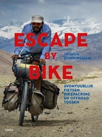 Fietsgids - Reisverhaal Escape by Bike | Joshua Cunningham
Avontuurlijk fietsen, toeren, bikepacken, fietsreizen, fietstoerisme, fietskamperen: de lijst met termen die wordt gebruikt voor fietsreizen breidt zich steeds verder uit. Fietsen staat voor een groot gevoel van vrijheid, het …
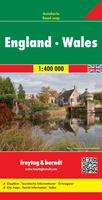 Wegenkaart - landkaart Engeland - Wales | Freytag & Berndt
Gedetailleerde, tweezijdige landkaart van Engeland en Wales op schaal 1:400.000, prima geschikt voor planning en rondtrekken. De berijdbare wegen zijn goed weergeven, zowel de hoofdwegen als provinciale en lokale wegen; …
★★★★★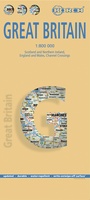 Wegenkaart - landkaart Groot - Brittannië | Borch
Mooie geplasticieerde kaart van Groot - Brittanië. Deze kaart biedt een goed overzicht van het land met detailkaarten. Our soft-laminated folded map of Great Britain shows: Scotland and Northern …
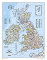 Wandkaart 02022 Britain and Ireland - Groot Brittannië en Ierland, 60 x 76 cm | National Geographic
This classic-style map of England and Wales shows political boundaries, major highways and roads, cities and towns, airports, and other geographic details. Thousands of place-names and exact borders are carefully …
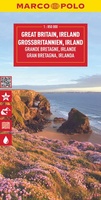 Wegenkaart - landkaart Great Britain & Ireland - Groot Brittannië & Ierland | Marco Polo
Duidelijke wegenkaart van Marco Polo: alle wegen, zowel de verharde als belangrijke onverharde wegen zijn weergegeven. Mooie toeristisch interessante wegen die de moeite waard zijn, zijn groen gearceerd. Veel toeristische …
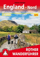 Wandelgids England Nord - Engeland Noord | Rother Bergverlag
Uitstekende wandelgids met 60 dagtochten. Met praktische informatie en beperkt kaartmateriaal! Wandelingen in verschillende zwaarte weergegeven in rood/blauw/zwart. Deze wandelgidsen uitgever staat hoog aangeschreven en is een begrip onder de …
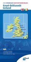 Wegenkaart - landkaart Groot-Brittanië en Ierland | ANWB Media
De ANWB heeft een grote serie wegenkaarten van de belangrijkste landen en streken. Het zijn echte overzichtskaarten van vaak een wat groter gebied. Deze keuze zorgt er voor dat de …
★★★★★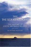 Reisverhaal The Sea Kingdoms – The history of Celtic Britain and Ireland | Alistair Moffat
Prachtig werk over de geschiedenis van Celtisch Groot Brittanië en Ierland door Alistair Moffat. Alistair Moffat's journey, from the Scottish islands and Scotland, to the English coast, Wales, Cornwall and …
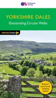 Wandelgids 015 Pathfinder Guides Yorkshire Dales | Ordnance Survey
Wandelgids van een deel van Engeland. Deze gids bevat 28 dagwandelingen, variërend van korte tochten tot pittige dagtochten. De bijbehorende kaarten zijn uitstekend: men heeft de topografische kaarten van Ordnance …
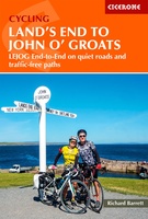 Fietsgids Land's End to John o' Groats | Cicerone
A guidebook describing Britain’s famous ‘End to End’ cycle route, a journey of almost 1000 miles from the very tip of southwest England – Land’s End – to the northernmost …
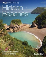 Reisgids - Natuurgids Hidden Beaches | Wild Things Publishing
Wild Swimming British Coast is een gids met beschrijvingen en foto's van de mooiste plekken om te zwemmen in de vrije natuur langs de kust van Engeland, Schotland en Wales …
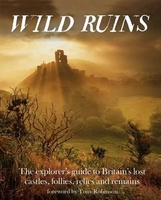 Reisgids Wild Ruins | Wild Things Publishing
Discover and explore Britain’s extraordinary history through its most beautiful lost ruins. From crag-top castles to crumbling houses in ancient forests, and ivy-encrusted relics of industry to sacred places long …
Laatste reviews

De kaart van Kirgystan is prachtig, zeer gedetailleerd. Kan niet wachten tot de we echt op reis hmgaan die kant op.
★★★★★ door Marijke Eering 21 november 2024 | Heeft dit artikel gekocht
Super handig fiets boekje en mooi water bestendig. En handig om op de kaarten te kijken heel duidelijk beschrijving. Wij fietsen al jaren in Duitsland …
★★★★★ door Jenneke holterman 19 november 2024 | Heeft dit artikel gekocht
prima kaart levering en betaling allemaal vlot verlopen
★★★★★ door Marc Buts 19 november 2024 | Heeft dit artikel gekocht
Ik heb een uitklapbare kaart van Londen gekocht voor toeristische doeleinden. Snel geleverd en een product die volledig voldoet aan de behoeften. Chapeau!
★★★★★ door Cees Lindenberg 18 november 2024 | Heeft dit artikel gekocht