Wandkaarten
Wandkaart kopen? Van landkaarten tot kinderwereldkaarten en prikborden, wij hebben een uitgebreide collectie in onze webshop
Verfraai uw interieur met een wandkaart aan de muur, bijvoorbeeld van uw favoriete vakantiebestemming, of van die bijzondere plaats waar u nog weleens naar terug wilt. Kies bijvoorbeeld voor een landkaart of een wereldkaart. Of voor een handig prikbord of educatieve, speelse kinderwereldkaart.
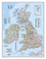 Wandkaart Britain and Ireland - Groot Brittannië en Ierland, 60 x 76 cm | National Geographic
This classic-style map of England and Wales shows political boundaries, major highways and roads, cities and towns, airports, and other geographic details. Thousands of place-names and exact borders are carefully …
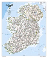 Wandkaart Ireland – Ierland, 76 x 91 cm | National Geographic
National Geographic Maps' new Ireland wall map is one of the most authoritative maps yet published of the Emerald Isle. Of the nearly 1,000 place-names shown on this map, all …
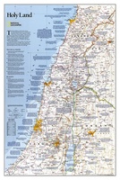 Wandkaart Holy Land – Israël, 53 x 80 cm | National Geographic
National Geographic Wall Maps offer a special glimpse into current and historical events, and they inform about the world and environment. Offered in a variety of styles and formats, these …
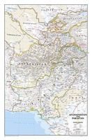 Wandkaart Afghanistan & Pakistan, 55 x 83 cm | National Geographic
This is the latest and most detailed map of the region - a perfect complement for following today's news stories. Afghanistan's 34 administrative provinces and Pakistan's provinces and territorial boundaries …
 Wereldkaart 97 World executive political, 136 x 84 cm | Maps International
Politieke wandkaart in bijzondere kleurstelling. De indeling van de kaart is natuurlijk wel up-to-date. De kaart is 136 x 84 cm groot en in het Engels. Alle landen staan er …
★★★★★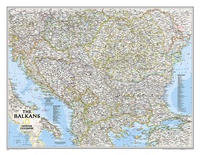 Wandkaart The Balkans - Balkan landen, 77 x 60 cm | National Geographic
Study the countries of the Balkans with our new map featuring the classic National Geographic reference styling. Features thousands of place names, accurate political boundaries, national parks, and major infrastructure …
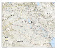 Wandkaart Iraq – Irak, 72 x 62 cm | National Geographic
This new map of Iraq, features the classic National Geographic reference styling. Features hundreds of place names, accurate political boundaries, and major infrastructure networks such as roads, oil fields and …
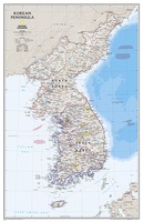 Wandkaart Korean Peninsula Noord- en Zuid Korea, 59 x 91 cm | National Geographic
Amid increasingly combative rhetoric from Pyongyang, North Korea, do you know where its underground nuclear test site or missile launch centers are located? Are you aware that the South Korean …
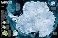 Wandkaart Antarctica Satellite Map, 78 x 50 cm | National Geographic
This digital mosaic of 4,500 satellite scans shows incredible detail of Antarctica's terrain. Includes insets that show the surface elevation, ice sheet thickness, ice flow velocity, and sea ice movement …
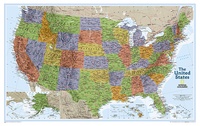
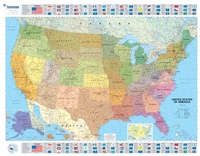 Wandkaart USA Politiek | Michelin
An annually updated political map of the USA. Beautifully coloured and laminated, with statistical information including population, surface area, state capital. Highlights the flags of each state. This laminated map, …
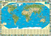 Kinderwereldkaart Dierenwereldkaart, 110 x 70 cm | Krüger & Schönhoff
Beleef de wonderlijke wereld van de dieren met deze informatieve, rijkelijk geïllustreerde Wereldkaart van de dieren! Kennis vergaren is een fantastische beleving! Deze dierenwereldkaart van Krüger & Schönhoff, decoratief en …
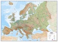 Wandkaart Europa Natuurkundig, 135 x 98 cm | Maps International
Maps International's large physical wall map of Europe is one of the finest money can buy. European Map details: Our large physical wall map of Europe features the natural …
 Wereldkaart 90 Antiek & politiek , 136 x 84 cm | Maps International
Politieke wandkaart in ouderwetse kleurstelling. De indeling van de kaart is natuurlijk wel up-to-date. De kaart is 136 x 84 cm groot en in het Engels. Alle landen staan er …
★★★★★ Wandkaart USA Explorer, 81 x 51 cm | National Geographic
This colorful USA political map clearly shows state boundaries, capitals, major highways, rivers, lakes, and many major cities. Insets show detail of Alaska and Hawaii. The United States Explorer map …
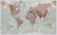
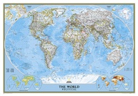 Wereldkaart politiek, 92 x 61 cm | National Geographic
Politieke wereldkaart van National Geographic. De klassieke blauwe vorm, met helder kaartbeeld. De landen hebben met kleuren duidelijke grenzen en er staan opvallend veel topografische details op. Ondanks de schaal …
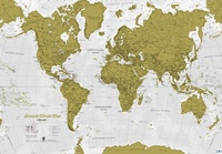 Scratch Map World Map Engels | Maps International
Met deze schitterende scratch map kun je de toplaag van de reeds bezochte bestemmingen weg krassen, waardoor de prachtig vormgegeven actuele wereldkaart eronder wordt onthuld. Het is de perfecte kaart …
★★★★★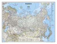 Wandkaart Russia – Rusland, 77 x 60 cm | National Geographic
Our classic wall map of Russia and the independent states of the former Soviet Union shows thousands of place names, roadways, political boundaries, bodies of water, airports, and many other …
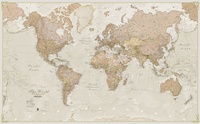
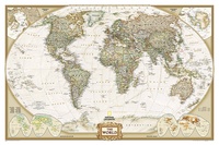
 Wereldkaart politiek & antiek, 296 x 193 cm | National Geographic
Een prachtige, stijlvol gekleurde kaart - bruin, antieke kleurstelling - met een modern kaartbeeld. Alle landen staan er met grenzen en belangrijke steden keurig op, maar de nadruk ligt op …
 Wereldkaart Politiek & antiek, 92 x 61 cm | National Geographic
Een prachtige, stijlvol gekleurde kaart - bruin, antieke kleurstelling - met een modern kaartbeeld. Alle landen staan er met grenzen en belangrijke steden keurig op, maar de nadruk ligt op …
 Wereldkaart 81X World Classic, pacific centered, 117 x 78 cm | National Geographic
Bijzondere wereldkaart vanuit een voor ons apart perspectief: de grote oceaan staat centraal. Prachtig beschaafd kleurgebruik en veel topografische aanduidingen maken het een mooie kaart. Volledig up-to-date. This unique …
Laatste reviews

We hebben een landkaart van Albanië besteld. Deze hebben we in goede staat ontvangen
★★★★★ door Ida van der Heiden 26 april 2024 | Heeft dit artikel gekocht
Zoals gewend van de Alpverein weer een mooie en duidelijke kaart voor dit mooie wandelgebied incl. hutten.
★★★★★ door B van R 26 april 2024 | Heeft dit artikel gekocht
Duidelijke en mooie kaart van het gebied. Oogt stevig/dik waardoor niet snel kapot tijdens wandelingen. Sommige tekens zijn wel wat aan de kleine kant waardoor …
★★★★★ door B van R 26 april 2024 | Heeft dit artikel gekocht
Voor een reis Ivoorkust is er weiniginformatie te vinden. Dit boek brengt het meeste. Duidelijk en overzichtelijk.
★★★★★ door Annemiek van Riezen 26 april 2024 | Heeft dit artikel gekocht