Kaarten
De beste wegenkaarten, routekaarten, fiets- of wandelkaarten en topografische kaarten vindt u hier!
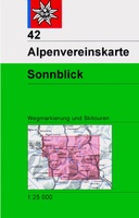
 Wandelkaart 42 Alpenvereinskarte Sonnblick | Alpenverein
De beste en meest gedetailleerde kaarten van met name de Duitse en Oostenrijkse alpen: wandelroutes zijn naar zwaarte onderscheidend gemarkeerd, gletsjeroverschrijdingen staan aangegeven en de verschillende soorten hutten zijn ingetekend. …
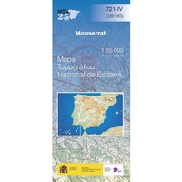
 Topografische kaart 721-IV Monserrat | CNIG - Instituto Geográfico Nacional
 Wegenkaart - landkaart Londen & Engeland Zuidoost | ITMB
 Wegenkaart - landkaart Mongolia - Mongolië | ITMB★★★★★
 Wegenkaart - landkaart Norway - Noorwegen | ITMB
Norway is one of the most popular countries for visitors in Europe. We spent an interesting time researching this map in Norway, travelling all the way north to Nordkapp, a …
 Wegenkaart - landkaart Nova Scotia & Prins Edwardeiland | ITMB★★★★★
 Wegenkaart - landkaart Panama | ITMB★★★★★★★★★★
 Wegenkaart - landkaart Andorra / Pyreneeën | ITMB
 Stadsplattegrond - Wegenkaart - landkaart Dubai / Verenigde Arabische Emiraten Oman | ITMB★★★★★
 Wegenkaart - landkaart Uganda | ITMB★★★★★★★★★★
 Wegenkaart - landkaart Uruguay / Montevideo | ITMB★★★★★
 Fietskaart Stirling / Forth Valley &The Trossachs | Harvey Maps
Cycling map of Stirling, the Forth Valley and the Trossachs at 1:80,000 scale Map shows 16 graded cycle routes with detailed route descriptions on reverse Includes enlargement of …
 Fietskaart Dales Noord | Harvey Maps
Detailed map with off-road cycle routes. GPS compatible. Rights of Way. Large area on a compact sheet. Yorkshire Dales North covers Swaledale and Wensleydale, including Keld, Hawes, Aysgarth and Leyburn.
 Fietskaart Dartmoor | Harvey Maps
New map for cycling on Dartmoor and the surrounding area. 2 maps in one: one side mountain biking the other side for cycle touring Tried and tested cycle …
 Fietskaart Cycle Rides in the Yorkshire Dales | Harvey Maps
8 cycle rides in the Yorkshire Dales varying in length from 11 to 23 miles. Includes detailed maps plus written route directions. Information on local points of interest and …
 Fietskaart Yorkshire Dales Cycleway | Harvey Maps
The entire cycle route on one sheet. The route is circular, starting and ending in Skipton, with an alternative start/end in Ilkley. The cycle map includes a route profile. Steep …
 Historische Kaart Verdun - Eerste Wereldoorlog | War travel
Themakaart over de geschiedenis van de Eerste Wereldoorlog in en rond Verdun. Met gedetailleerde inzetten van Verdun, Argonne en Saint-Michel. Aandacht voor monumenten, musea, vestingen, loopgraven en kerkhoven. Mooi kleurgebruik, …
 Wandelkaart Cannock Chase | Harvey Maps
New 1:25,000 scale map of this popular area in the West Midlands. Ideal for walking, mountain biking and other outdoor activities. Made with support from the Cannock Chase Area of …
 Fietskaart Yorkshire Dales Touring / Nidderdale Area of NB | Harvey Maps
This map provides a colourful overview of the Dales - famous Swaledale, Wensleydale, Wharfedale & Nidderdale. Colour shading makes it easy to pick out the hills & dales. Driveable roads …
 Fietskaart Yorkshire Dales for Cyclists | Harvey Maps
The area covered by this new 100% waterproof map provides fabulous opportunities from gentle routes in the valleys to some challenging climbs over the moorland that separates them. It is …
Laatste reviews

Ik heb deze kaart gebruikt bij het wandelen van Zuid naar Noord Lanzarote. De kaart blijft zelfs goed bij vouwen en buigen.
★★★★★ door saar 25 november 2024 | Heeft dit artikel gekocht
Goede kaart, waterbestendig
★★★★★ door Bas 25 november 2024 | Heeft dit artikel gekocht
Was een hele goede keuze geweest. Enorm tevreden.
★★★★★ door Annet kriesels-Potters 25 november 2024 | Heeft dit artikel gekocht
zie boven
★★★★★ door Sabine Cohen 25 november 2024 | Heeft dit artikel gekocht

