Mandje Tel: +31503126950 Menu
Winkelwagen
Geen items in winkelwagen
Ga naar winkelwagen

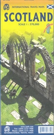
Wegenkaart - landkaart Scotland - Schotland | ITMB (9781771297349)

  • ISBN / CODE: 9781771297349
  • Editie: 15-04-2024
  • Druk: 5
  • Aantal blz.: 1
  • Schaal: 1:370000
  • Uitgever: ITMB
  • Soort: Wegenkaart
  • Taal: Engels
  • Hoogte: 25.0 cm
  • Breedte: 10.0 cm
  • Dikte: 1.0 cm
  • Gewicht: 109.0 g
  • Uitvoering: Scheur- en watervast
  • Bindwijze: -
  • Beoordeling: 4,0 ★★★★★ (1 review) Schrijf een review
  • 13,95

    Op voorraad. Binnen 2 - 3 werkdagen in huis in Belgie Levertijd Nederland Voor 17.00 uur op werkdagen besteld, morgen in huis in Nederland Levertijd Belgie

    Gratis verzending in Nederland vanaf €35,-

Beschrijving

Anyone who has been in this business for a few years remembers Ordnance Survey and their brilliantly detailed artwork. They should also remember that OS guarded this artwork religiously. That all changed when the then head of government in the UK, one soon-forgotten Gordon Brown, decreed that commercial OS artwork had to be discontinued and artwork had to be made more freely available to users. I expected an outpouring of new artwork by private UK firms. It did not happen; in fact, the range of travel maps decreased dramatically. However, OS artwork is still an excellent source of mapping artwork. This is a wonderful double-sided, detailed map of Scotland. It is both extremely detailed and accurate. We have added symbols for parks, historic sites, battlefields, country hotels, and anything else that we think would interest visitors. In order to portray Scotland to best scale advantage, the only inset included with this map are those of outlying islands, such as the Shetlands. ITMB also publishes a separate, less detailed map of Scotland on one side with Edinburgh of the other side. The new Scotland map has also been upgraded to being printed on plastic paper for durability. It also makes a good umbrella for when the Scotch mist falls! By the way, our forthcoming map of England and Wales should be available in about two months. 
 
Map size: 27*39"
 
Legend Includes:
Roads by classification, Motorway, Divided Highway, Main Road, Ferry Route, Point of interest, Castle, Museums, Theme Park, Zoo, Golf course, National Park, and much more.

Reviews

Prima kaart

Prima bruikbare kaart.

★★★★★ door A van der Toolen 26 oktober 2016

Vond u dit een nuttige review? (login om te beoordelen)

-
Nee (0)

Schrijf een review

Graag horen wij wat u van dit artikel vindt. Vindt u het goed, leuk, mooi, slecht, lelijk, onbruikbaar of erg handig: schrijf gerust alles op! Het is niet alleen leuk om te doen maar u informeert andere klanten er ook nog mee!