Wandelkaart Ben Nevis | Harvey Maps (9781851375776)
- ISBN / CODE: 9781851375776
- Editie: 01-12-2022
- Aantal blz.: 1
- Schaal: 1:40000
- Uitgever: Harvey Maps
- Soort: Wandelkaart
- Serie: Ultramap XT40
- Taal: Engels
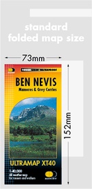
- Hoogte: 15.0 cm
- Breedte: 7.0 cm
- Gewicht: 30.0 g
- Uitvoering: Scheur- en watervast
- Bindwijze: -
- Schrijf als eerste een review
-
€ 19,50
Leverbaar in 3 - 5 werkdagen in huis in Nederland Levertijd Belgie
Gratis verzending in Nederland vanaf €35,-
-
Overzicht Ultramap XT40

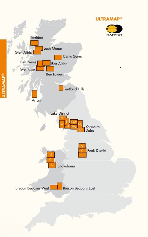
Producten op deze overzichtskaart:
Klik op een product om naar de pagina van dat product te gaan.
- Wandelkaart Arran | Harvey Maps
- Wandelkaart Arrochar Alps | Harvey Maps
- Wandelkaart Ben Alder | Harvey Maps
- Wandelkaart Ben Lawers & Schiehallion | Harvey Maps
- Wandelkaart Ben Nevis | Harvey Maps
- Wandelkaart Brecon Beacons Oost | Harvey Maps
- Wandelkaart Brecon Beacons West | Harvey Maps
- Wandelkaart Cairn Gorm & Ben Avon | Harvey Maps
- Wandelkaart Crieff & Comrie | Harvey Maps
- Wandelkaart Dartmoor Noord | Harvey Maps
- Wandelkaart Dartmoor Zuid | Harvey Maps
- Wandelkaart Glen Affric | Harvey Maps
- Wandelkaart Glen Coe | Harvey Maps
- Wandelkaart Lake District Noord | Harvey Maps
- Wandelkaart Lake District Oost | Harvey Maps
- Wandelkaart Lake District West | Harvey Maps
- Wandelkaart Lake District Zuid Oost | Harvey Maps
- Wandelkaart Loch Earn | Harvey Maps
- Wandelkaart Loch Lomond & The Trossachs | Harvey Maps
- Wandelkaart Loch Monar | Harvey Maps
- Wandelkaart North York Moors Oost | Harvey Maps
- Wandelkaart North York Moors West | Harvey Maps
- Wandelkaart Ochil Hills | Harvey Maps
- Wandelkaart Peak District Central | Harvey Maps
- Wandelkaart Peak District Noord | Harvey Maps
- Wandelkaart Peak District Zuid | Harvey Maps
- Wandelkaart Pentland Hills | Harvey Maps
- Wandelkaart Suilven / Stac Pollaidh / Lochinver | Harvey Maps
- Wandelkaart Torridon | Harvey Maps
- Wandelkaart Trossachs Noord | Harvey Maps
- Wandelkaart Yorkshire Dales Noord Oost | Harvey Maps
- Wandelkaart Yorkshire Dales Noord West | Harvey Maps
- Wandelkaart Yorkshire Dales Zuid Oost | Harvey Maps
- Wandelkaart Yorkshire Dales Zuid West | Harvey Maps
Overzichtskaarten
Beschrijving
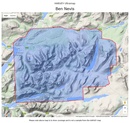
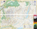
HARVEY launch innovative new series: Ultramap XT40. 16 titles featuring in Trail magazine through spring 2016. 40 years experience have gone into HARVEY's most creative new series. The Ultramap covers a large area yet is small enough to slip in a pocket. Actual size 73mm x 152mm. The Ultramap is fully detailed genuine original HARVEY mapping. The Ultramap is tough and 100% waterproof. Use it without a map case, whatever the weather! To provide the biggest area on the smallest lightest sheet, the Ultramap is printed double sided. The ingenious folding pattern allows you to open the Ultramap directly to any part, and either side, of the sheet. The two sides are aligned, so when you reach the edge of the Ultramap sheet you simply flip it over without re-folding. There's an overlap as well, so you can map read continuously. The magic scale of 1:40,000 enables the Ultramap to provide all the detail you would expect to find on a large scale walking map, including rights of way and boundaries. Plastic pocket for protection. The area covered on this map includes Ben Nevis, Mamores and Grey Corries including 23 Munros, 6 Corbetts and an enlargement of the summit of Ben Nevis.
Reviews
Geen reviews gevonden voor dit product.
Schrijf een review
Graag horen wij wat u van dit artikel vindt. Vindt u het goed, leuk, mooi, slecht, lelijk, onbruikbaar of erg handig: schrijf gerust alles op! Het is niet alleen leuk om te doen maar u informeert andere klanten er ook nog mee!

