Wandelkaart Pallas Hetta Olos | Karttakeskus (9789522667151)
- ISBN / CODE: 9789522667151
- Editie: 30-09-2021
- Aantal blz.: 1
- Schaal: 1:50000
- Uitgever: Karttakeskus
- Soort: Wandelkaart
- Serie: Outdoor map
- Taal: Engels, Fins
- Hoogte: 25.0 cm
- Breedte: 10.0 cm
- Gewicht: 51.0 g
- Uitvoering: Scheur- en watervast
- Bindwijze: -
- Schrijf als eerste een review
-
€ 22,95
Dit artikel is (tijdelijk) niet leverbaar
-
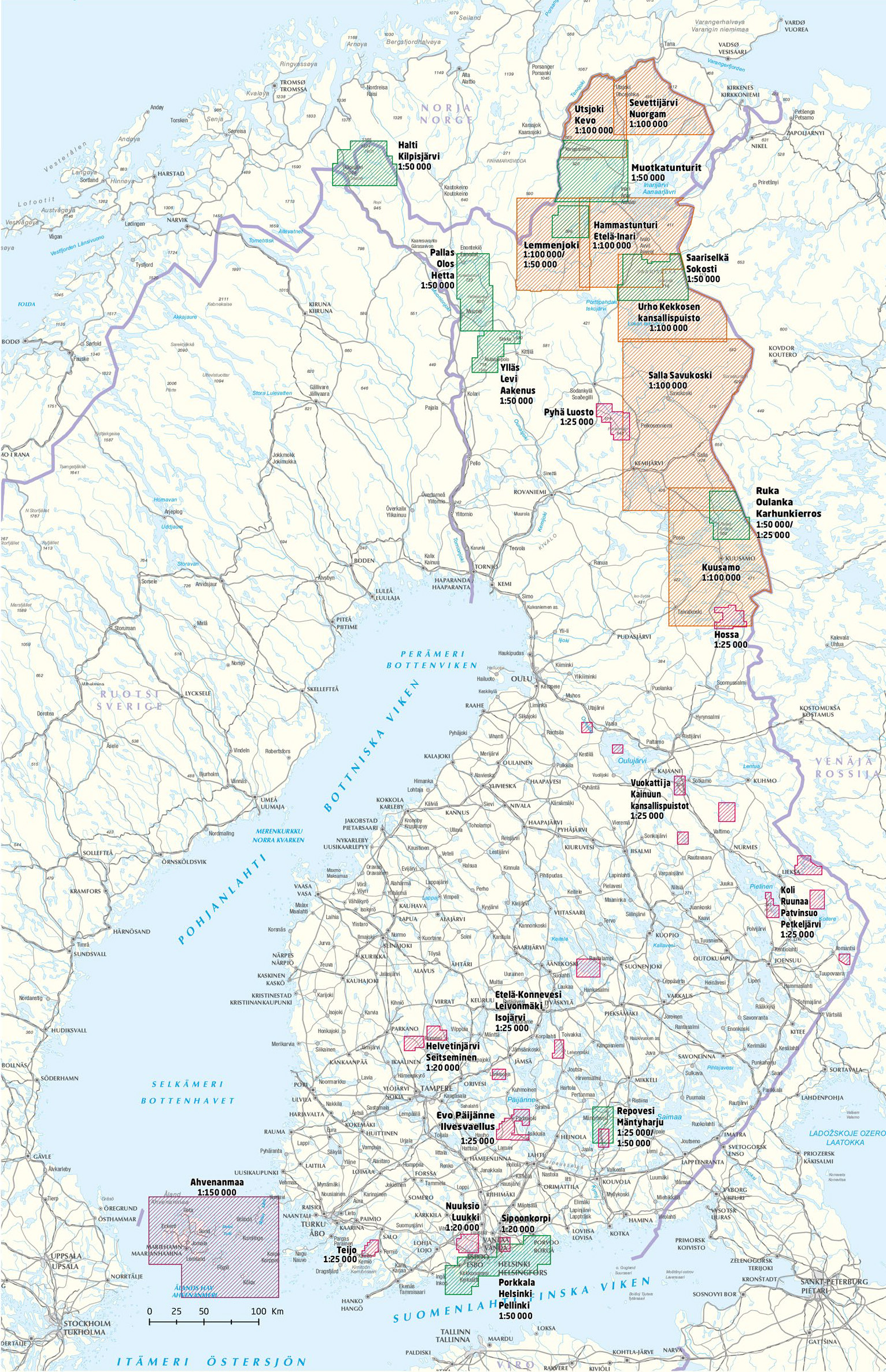
Outdoor kaarten Finland | Karttakeskus


Producten op deze overzichtskaart:
Klik op een product om naar de pagina van dat product te gaan.
- Wandelkaart Etela-Konnevesi Leivonmaki | Karttakeskus
- Wandelkaart Evo Päijänne ilvesvaellus | Karttakeskus
- Wandelkaart Halti Kilpisjärvi | Karttakeskus
- Wandelkaart Hammastunturi Ivalojoki Juutua | Karttakeskus
- Wandelkaart Helvetinjärvi Seitseminen | Karttakeskus
- Wandelkaart Hossa | Karttakeskus
- Wandelkaart Kuusamo | Karttakeskus
- Wandelkaart Lemmenjoki | Karttakeskus
- Wandelkaart Nuuksio Luukki | Karttakeskus
- Wandelkaart Pallas Hetta Olos | Karttakeskus
- Wandelkaart Pyha Luosto | Karttakeskus
- Wandelkaart Repovesi Mäntyharju | Karttakeskus
- Wandelkaart Ruka Oulanka Karhunkierros | Karttakeskus
- Wegenkaart - landkaart Sevettijärvi Nuorgam | Karttakeskus
- Wandelkaart Teijo | Karttakeskus
- Wandelkaart Teijo Kurjenrahka | Karttakeskus
- Wandelkaart Utsjoki Kevo Paistunturit | Karttakeskus
- Wandelkaart Vuokatti ja Kainuun kansallispuistot | Karttakeskus
- Wandelkaart Ylläs Levi Aakenus | Karttakeskus
Overzichtskaarten
Beschrijving
Van de uitgever
HIKING MAP PALLASDouble-sided map
Relief shown by contours
Detailed picture of the terrain and vegetation
Hiking paths, skiing and cycling routes
Accommodation (hotels, huts, refuges and campgrounds)
Tourist and outdoor activities informations
GPS compatible
Legend in english
The outdoor recreation maps cover the most important camping sites from Northern Finland to the wilderness areas of Southern Finland. The maps are based on the exact terrain maps and therefore it is easy to find the destination in the terrain. All the services needed by the hiker have been presented with symbols and texts. Also the sights are marked on the map. Precise scale makes it possible to find even the most minute roads as well as the points of interest.
Reviews
Geen reviews gevonden voor dit product.
Schrijf een review
Graag horen wij wat u van dit artikel vindt. Vindt u het goed, leuk, mooi, slecht, lelijk, onbruikbaar of erg handig: schrijf gerust alles op! Het is niet alleen leuk om te doen maar u informeert andere klanten er ook nog mee!


