Categorieën
-
Boeken
- Aanwijswoordenboeken
- Accommodatiegidsen
- Atlassen
- Bed and Breakfast Gidsen
- Bergsporthandboeken
- Campergidsen
- Camperhandboeken
- Campinggidsen
- Duikgidsen
- Fietsatlassen
- Fietsgidsen
- Fotoboeken
- Historische Atlassen
- Kanogidsen
- Kinderatlassen
- Kinderreisgidsen
- Kleurboeken
- Klimgids - Klettersteiggidsen
- Klimgids - Klimtopo
- Kookboeken
- Mountainbikegidsen
- Natuurgidsen
- Pelgrimsroutes
- Reisboeken
- Reisdagboeken
- Reisfotografiegidsen
- Reisgidsen
- Reishandboeken
- Reisinspiratieboeken
- Reisverhalen
- Sneeuwschoenwandelgidsen
- Survivalgidsen
- Tourskigidsen
- Treinreisgidsen
- Vaargidsen
- Vogelgidsen
-
Wandelgidsen
- Afrika
- Azië
-
Europa
- Albanië
- Andorra
- Armenië
- België
- Bosnië - Hercegovina
- Bulgarije
- Cyprus
- Denemarken
- Duitsland
-
Engeland
- Noord Engeland
- North East England
- ♦ Northumberland National Park
- Yorkshire and the Humber
- ♦ Yorkshire Dales Nationaal Park
- ♦ North York Moors Nationaal Park
- ■ York
- North West England
- ♦ Cumbria
- ♦ Isle of Man
- ♦ Lake District Nationaal Park
- ♦ North Pennines AONB
- ■ Liverpool
- ■ Manchester
- 🥾 Hadrian's Wall Path
- East Midlands
- West Midlands
- ♦ Peak District Nationaal Park
- ■ Birmingham
- Wales
- Swansea and the Gower
- ♦ Pembrokeshire Coast National Park
- ♦ Snowdonia Nationaal Park
- ♦ Brecon Beacons Nationaal Park
- East of England - East Anglia
- ♦ The Broads National Park
- South West England
- Cornwall
- Devon
- Dorset
- ■ Bath
- ♦ Cotswolds AONB
- ♦ Devon - Cornwall
- 🥾 South West Coast Path
- ♦ New Forrest National Park
- ♦ Exmoor National Park
- ♦ Dartmoor National Park
- ■ Bristol
- South East England
- ♦ Kent
- ♦ South Downs Nationaal Park
- ♦ Isle of Wight
- ■ Londen
- ■ Oxford
- Kanaaleilanden
- ♦ Guernsey
- ♦ Jersey
- Meer steden
- Estland
- Faroer
- Finland
- Frankrijk
- Georgië
- Griekenland
- Groenland
- Hongarije
- IJsland
- Ierland
- Italië
- Kosovo
- Kroatië
- Letland
- Liechtenstein
- Litouwen
- Luxemburg
- Malta
- Montenegro
- Nederland
- Noord-Ierland
- Noord-Macedonië
- Noorwegen
- Oostenrijk
- Polen
- Portugal
- Roemenië
- Scandinavië
- Schotland
- Servië
- Slovenië
- Slowakije
- Spanje
- Tsjechië
- Turkije
- Zweden
- Zwitserland
- Midden-Amerika
- Midden-Oosten
- Noord-Amerika
- Oceanië
- Wereld
- Zuid-Amerika
- Watersport handboeken
- Werken en wonen in buitenland
- Woordenboeken & Taalgidsen
- Kaarten
- Opruiming
- Puzzels
- Travel Gadgets
- Wandkaarten
- Wereldbollen
Veilig online betalen
Betaal veilig via uw eigen bankomgeving
Winkelwagen
Geen items in winkelwagen
Ga naar winkelwagen
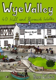
Wandelgids Wye Valley | Pocket Mountains (9781907025013)
40 Hill and Riverside Walks
- ISBN / CODE: 9781907025013
- Editie: 2009
- Aantal blz.: 96
- Auteur(s): Ben Giles
- Uitgever: Pocket Mountains
- Soort: Wandelgids
- Taal: Engels
- Bindwijze: Paperback
- Uitvoering: -
- Schrijf als eerste een review
-
€ 10,95
Dit artikel is (tijdelijk) niet leverbaar Dit artikel is (tijdelijk) niet leverbaar
- Afbeeldingen
- Inkijkexemplaar
Beschrijving
This guide contains forty circular routes, covering an area somewhat broader than the AONB but within similar north-south boundaries. This collection of walks is split into five areas: Hereford Lowlands and the Woolhope Dome; Archenfield and the Monnow and Trothy Valleys; The Wye Gorge; The Forest of Dean; The Trellech to Chepstow Plateau. In part, the areas reflect the diverse geology and ecology of the landscape, but they are in no way essentially distinct or separate. Each has its own particular attractions and character, but there is much that is shared between all five areas.
Most of the routes are intended as comfortable walks or strolls, manageable by all willing to put one foot in front of another, at most requiring half a day to complete. Occasionally, the cumulative ascent may leave unseasoned legs a little stiffer, but in general the walking is on well-worn paths, lanes and tracks, which should require minimal time and effort for route-finding. However, the sketch maps serve an illustrative purpose and it is recommended that the relevant OS 1:25,000 map is carried – just two are needed to cover all areas (OS Explorers OL14 and 189), both of which are readily available in local shops. For those who enjoy full day walks, some routes can readily be lengthened, while others can be combined for a longer excursion. The recommended time given for each walk is an estimate based on average walking speed, with an allowance added in for ascent and the type of ground. This will vary significantly, with individual ability and preference as well as the seasonal effects on conditions underfoot – especially across fields. It is hoped that there is plenty of interest along the routes themselves and it would be very possible to spread a short walk over a half day; conversely, most routes are short enough to attempt two in a day.
Reviews
Geen reviews gevonden voor dit product.
Schrijf een review
Graag horen wij wat u van dit artikel vindt. Vindt u het goed, leuk, mooi, slecht, lelijk, onbruikbaar of erg handig: schrijf gerust alles op! Het is niet alleen leuk om te doen maar u informeert andere klanten er ook nog mee!
Alle gerelateerde rubrieken >
Ook interessant voor europa/engeland/wales
-

Wandelkaart - Topografische kaart 15
€ 19,50Topografische kaarten Wales -

Wandelkaart - Topografische kaart 17
€ 25,95Topografische kaarten Wales -

Wandelkaart - Topografische kaart 14
€ 25,95Topografische kaarten Wales -

Wandelkaart - Topografische kaart 17
€ 19,50Topografische kaarten Wales -

Wandelkaart - Topografische kaart 15
€ 25,95Topografische kaarten Wales


