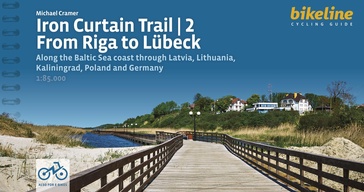
Praktische fietsgids voor een gedeelte van de Iron Curtain Trail, van Riga naar Lübeck. Met detailkaarten, ingetekende route, informatie over overnachten en fietsenmakers, zwaarte en hoogteprofiel. In spiraalbinding, Engelstalig.
The cycling guide contains all the information you need for your cycling vacation along the European Iron Curtain Trail between Riga and Lübeck: Precise maps, a detailed description of the route, a comprehensive list of overnight accommodation, numerous detail maps of cities and towns, and information about the most significant sights. And all that information comes with our bikeline pledge: The route described in this book has been tested and evaluated in person by the author! To assure that the book is as up-to-date as possible, we welcome corrections submitted by readers and local officials or businesses. We cannot, however, always check and confirm such changes before deadline.
The maps
The detail maps are produced in a scale of 1:85,000 (1 centimeter = 850 meters). In addition to exactly describing the route, these maps also provide information about roadway quality (paved or unpaved), climbs (gentle or steep), distances, as well as available cultural and culinary highlights. Even with the most precise map, consulting the written description of the route may be necessary at times. Locations where the route is difficult to follow are shown by the #? symbol on the maps, the same symbol can then be found in the written description where the route is explained in detail. Note that the recommended main route is always shown in red or purple; alternative and excursion routes in orange. The individual symbols used in the maps are described in the legend on pages?4 and 5. Route altitude profile The route altitude profile in the introduction provides a graphic depiction of elevations along the route, the total length, and the location of larger towns and cities along the way. Additionally, a detailed altitude profile is provided at the beginning of each section which shows many of the smaller centers along the way as well as the waypoints, giving you a direct reference to the maps and route description. The latitude profiles do not show every individual small hill and dip, but only the major changes in elevation. On the detail maps smaller gradients are shown by arrows that point uphill.
The text
The maps are supplemented by a written text that describes the recommended main route. Key phrases about the route description are indicated with the ?#- symbol. The description of the main route is also interrupted by passages describing alternative and excursion routes. These are printed in orange colour. Furthermore, the names of important villages, towns and cities are printed in bold type. If a location or community has important points of interest, addresses, telephone numbers and opening times are listed under the headline with the name of the place. Descriptions of the larger towns and cities, as well as historic, cultural and natural landmarks help round out the travel experience. These paragraphs are printed in italics to distinguish them from the route description.
List of overnight accommodation
The last pages of this cycling guide provide a list of convenient hotels and guest houses in virtually every village or town along the route. This list also includes youth hostels and campgrounds.


