Mandje Tel: +31503126950 Menu
Winkelwagen
Geen items in winkelwagen
Ga naar winkelwagen

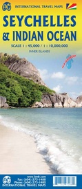
Wegenkaart - landkaart Seychellen & Indische Oceaan | ITMB (9781771297288)

  • ISBN / CODE: 9781771297288
  • Editie: 19-10-2022
  • Druk: 1
  • Aantal blz.: 1
  • Schaal: 1:45000
  • Uitgever: ITMB
  • Soort: Wegenkaart
  • Taal: Engels
  • Hoogte: 25.0 cm
  • Breedte: 10.0 cm
  • Gewicht: 123.0 g
  • Bindwijze: -
  • Uitvoering: Scheur- en watervast
  • Schrijf als eerste een review
  • 13,95

    Op voorraad. Binnen 2 - 3 werkdagen in huis in Belgie Levertijd Nederland Voor 17.00 uur op werkdagen besteld, morgen in huis in Nederland Levertijd Belgie

    Gratis verzending in Nederland vanaf €35,-

Beschrijving

Aan de ene kant een degelijke kaart van de Seychellen, schaal 1:45.000, met aanduidingen van o.a. nationale parken, vliegveld, benzinepomp, dirt-roads. As overzichtskaart goed te gebruiken.
Aan de andere kant een overzicht van de Indische oceaan, schaal 1:10.000.000
 
This is actually two brand new maps in one.  This is a brilliant new map of the Seychelles archipelago and a first-ever map of the entire Indian Ocean. The islands of the Seychelles are too widely-spaced to portray except by as a series of ten insets. The main island is Mahe, which also houses the capital of Victoria (inset provided) and numerous resorts. Many of the islands have French names, reflecting the colonial to-and-fro that typified relations between Britain and France. Praslin, Curiuse, Falicite, La Digue, and Desroches are not names that bring immediate recognition, but they are the names of islands belonging to the Seychelles. The map shows dozens of resorts, as well as restaurants, touristic sites, historic sites, ferry docks, parks, and shopping areas. The reverse side covers the Indian Ocean as a marine map, with underwater ridges portrayed and countries portrayed politically in differing colours. The ocean nations of Comoros, Reunion, BIOT, Maldives, and Andaman/Nicobar Islands are likely only to be mapped in this context. It is an interesting map.
 
Legend Includes:
Roads by classification, Rivers and Lakes, National Park, Airports, Points of Interests, Highways, Main Roads, Zoos, Fishing, and much more...


Reviews

Geen reviews gevonden voor dit product.

Schrijf een review

Graag horen wij wat u van dit artikel vindt. Vindt u het goed, leuk, mooi, slecht, lelijk, onbruikbaar of erg handig: schrijf gerust alles op! Het is niet alleen leuk om te doen maar u informeert andere klanten er ook nog mee!